

Who knew that a non-violent uprising that began two years ago would end in brutal government crackdown?
When millions of people joined their hands in a peaceful crusade against the autocratic ruler, President of Syria- Bashar Assad, little did they know that their mutual dissent would be met by Assad’s bitter military forces! The tyranny that Syrian people and Arabs witnessed from the hands of Assad ultimately led to a grinding civil war that involved conflicting regime and rebel forces. United Nations, a prime organization of different countries claims that over 70000 civilians have been brutally killed in the last two years of bloodshed while the neighbouring countries are still dealing with the issue of Syrian refugees.
In these 24 months, the world has witnessed the valour of rebels as well as the courage of local and international reporters. In fact, due to its complex geopolitical terrain, the war managed to affect a number of bordering countries, ultimately causing international community to intervene. The world was divided: Syrian opposition being disorganized and one rebel unit branded as terrorist outfit while other section considered that the rebel needed to be ended to forge peace.
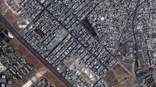
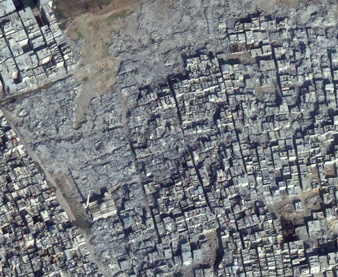
But in both the cases, international community tried its best to initiate compromises, getting elites to negotiate, to support the population. But now, with satellite images revealing the state of war clad Syria, millions are noticing how the country has turned into a battlefield with guerrilla outfits, criminal gangs, extremists, insurgents and a regime that grimly tries to cling to its power and lineage.
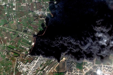
DigitalGlobe, a commercial satellite organization recently revealed the level of destruction caused by the civil war. Comparison between images from March 2003 and January 2013 show that in Damascus, a local mosque has been reduced to slumber and rubbles. But that’s not all! With Syria being ravaged by war, historic neighbourhoods of areas like Homs and Aleppo are nothing but wastelands. The once swinging crops of wheat have now paved way for lands marked with craters – all thanks to Artillery fires! An emotionally overwhelming image depicts how large areas of land have been dug up to be used as mass graves.
DigitalGlobe is known for taking high resolution images through its five satellites. Such images, clicked with zooming cameras, are used for a variety of purposes. But even DigitalGlobe workers were stunned when they saw the devastation unfolding in front of their eyes. Wood, a representative narrated the horror, “We could very clearly see evidence of smoke rings coming off an artillery position and the corresponding down range impact further afield.” He also mentioned that they saw firing on Bab Amr and how the opposition couldn’t retaliate as the rebelling population didn’t have such weapons.
Currently, French Photojournalist, William Daniels and Remi Ochlik are doing an assignment on the ordeals of this war ravaged nation.